How Sea Ice Changes Antarctica Cruise Routes
 By Oleg G.
Sea ice, not distance, decides where an Antarctica cruise can actually go. Here is how the ice edge moves through the season, why the Weddell Sea and the Antarctic Circle open late, and what your ship's ice class really means for the route.
Quick answer: Sea ice is one of the biggest variables in Antarctica cruise routing. November sailings face the most ice and the fewest open routes, February the least, and Antarctic Circle crossings depend on ice retreating far enough to pass south of 66 degrees 33 minutes south. Ships plan with daily ice charts from bodies such as the US National Ice Center.
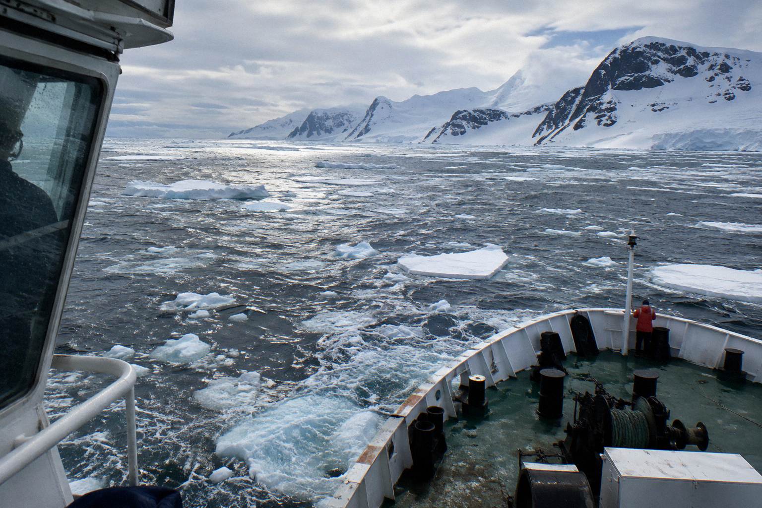
Sea ice is the quiet author of every Antarctica cruise itinerary. The map an operator publishes in spring is a plan, not a promise: the captain, the expedition leader and the ice charts decide what actually happens, day by day, once the ship is down there. Roughly 98 percent of all tourism voyages happen in the Antarctic Peninsula region during the austral summer, according to the Antarctic Treaty Secretariat's tourism page, and even within that narrow window the amount of floating ice changes enormously from November to March. A cruise that reaches the far side of the Peninsula in February may be turning back at the same coordinates in November.
This matters for anyone comparing voyages. Two nearly identical-sounding Antarctic cruises can deliver completely different routes simply because of the week they sail. Understanding the ice cycle, and what your ship's hull is rated to handle, is the difference between booking an itinerary on paper and booking one you will actually get to sail. If you are weighing several departures, a free Antarctica cruise consultation can help you match the month to the route you want.
How Sea Ice Shapes Every Antarctica Cruise Route
Sea ice is one of the biggest factors in Antarctica cruise routing: it closes landing sites in November, opens the far south in late January and February, and can force a captain to swap a planned destination for a sheltered bay in a single afternoon. Every published itinerary is therefore a best-case plan that the ice can override at any point in the voyage.
Antarctic tourism runs on a simple rhythm: the season concentrates on the Peninsula because that is where the ice retreats first and most reliably. The Antarctic Treaty Secretariat notes that approximately 98 percent of tourism voyages occur in the Peninsula region across the seven-month austral summer from October to April. Within that summer, the ice edge is in constant motion. Early in the season, sea ice extent is at its greatest, restricting some Peninsula routes and landing sites, according to seasonal summaries of 2026-27 conditions. Fresh snow lies deep on land, and some sites may simply be snowed in or ice-blocked in November.
As the summer progresses, the picture changes. Ice recedes through December and January, opening more of the coast, and by late January and February there is generally less ice, which is what makes deeper southern access and Antarctic Circle crossings more feasible. March brings further retreat, though conditions remain variable. The practical consequence for a traveller is that the same route name, "Antarctic Peninsula", describes a very different trip in the first week of November and the second week of February. Neither is better; they are different products, priced differently and delivering different landscapes.
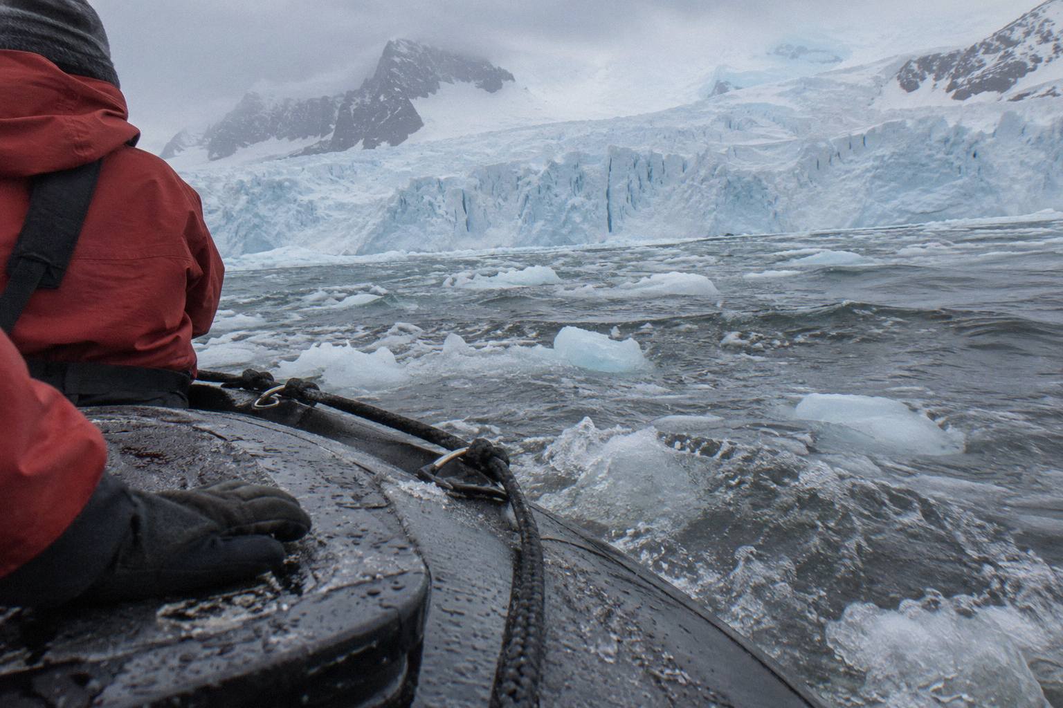
It also works at the daily level. Ice is not a wall that either stands or falls; it is a shifting field of floes, brash and fast ice that a ship can sometimes weave through and sometimes cannot. That is why experienced Antarctica hands treat the day-by-day programme, announced each evening on board, as the real itinerary, and the brochure as a set of intentions. Our expectations versus reality guide covers this in more depth for first-timers.
| Month | Typical Ice Conditions On The Peninsula | What It Means For Your Route |
|---|---|---|
| November | Greatest sea ice extent, fresh deep snow on land | Some landing sites and channels closed or limited; pristine, less-visited landscapes |
| December | Ice receding, more coast opening | Most classic Peninsula routes work; Circle crossings still uncertain |
| January | Continued retreat, seasonal minimum approaching | Farther south often possible; busiest month for ships |
| February | Least sea ice of the season | Best window for Antarctic Circle crossings and deeper southern access |
| March | Further retreat but variable | Late-season whale focus; some sites wind down as the season closes |
Why The Weddell Sea And Antarctic Sound Are Ice Gateways
Weddell Sea and Antarctic Sound routes are heavily influenced by pack ice, so access depends on the season and on weekly ice conditions rather than on the itinerary printed in a brochure.
Antarctic Sound, the narrow passage between the tip of the Peninsula and Joinville Island that ships use to enter the Weddell from the Bransfield Strait, is heavily influenced by pack ice, and its state can change a voyage's plan overnight. Seasonal route analyses for 2026-27 note plainly that Weddell Sea and Antarctic Sound routes are at the mercy of the pack, and that Circle-success and deep-southern itineraries generally depend on how far the ice has retreated.
What does that mean in practice? Ice is greatest early in the season, so a Weddell Sea itinerary depends heavily on how far the pack has retreated. The specialist exception is the Weddell Sea emperor penguin voyage, which targets November and December and often uses helicopters for access when ice conditions allow. If a Weddell Sea crossing is the specific experience you are buying, the departure month matters more than the ship, and it is worth talking through the timing with a specialist before committing to a fare.
There is a second, quieter consequence. Because the ice edge on the Weddell side retreats unevenly, two ships leaving Ushuaia on the same day can end up on opposite sides of the Peninsula, one in the calm western channels and one threading the Sound, purely on the strength of that week's ice charts. Neither crew is improvising recklessly; both are reading the same data. The difference is that one had a window and the other did not.
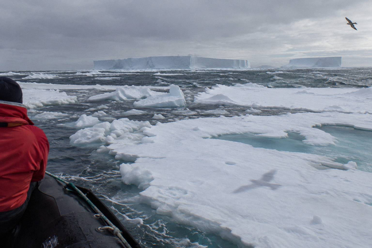
For travellers, the honest framing is this: the Weddell Sea is a bonus that the ice grants or withholds. The western Peninsula, with its gentler ice regime and sheltered bays, is the reliable core of Antarctic cruising, and our Antarctic Peninsula cruise guide explains what that core route delivers. Book the Weddell as an ambition, not a guarantee, and you will not be disappointed when the captain announces a change of plan.
When Does The Antarctic Circle Open For Cruise Ships
The Antarctic Circle at 66 degrees 33 minutes south opens most reliably in the second half of the season: sea ice is at its minimum from late January through February, and Circle-crossing voyages succeed or fail depending on whether the ice has retreated far enough for a ship to pass south of that line and come back.
Crossing the Antarctic Circle is one of the few genuinely binary achievements in Antarctic cruising: either the ship gets south of 66 degrees 33 minutes south or it does not. Seasonal analyses for 2026-27 are blunt about the mechanism, noting that Circle success depends on ice conditions allowing passage south of the line, and that February, when ice is at its seasonal minimum, offers the best conditions for the crossing. Circle crossings are described as most feasible from late January through February and March, so a December crossing attempt carries lower odds.
A ship must find a gap in the marginal ice zone, transit south, and return, all within a weather window. When the ice edge sits north of the Circle, the voyage becomes a scenic approach and a turnaround, which is why the crossing is always described as ice-dependent. Our Antarctic Circle cruise guide lists what these voyages typically include and how to read the fine print.
Daylight helps and hurts at once. Around the December solstice the far south enjoys near-continuous daylight, with the Antarctic Circle itself experiencing midnight sun, but December ice is usually still too extensive for reliable crossings. By February the daylight has shortened to roughly 16 and a half hours at the Circle, yet the ice has retreated enough to make the transit realistic. That trade-off, light versus access, defines the late-season decision.
| Route Ambition | Best-Probability Window | Why |
|---|---|---|
| Classic western Peninsula landings | November onward | Season runs November to March; some sites stay blocked in November |
| Antarctic Sound transit into the Weddell | Not stated | Routes heavily influenced by pack ice |
| Antarctic Circle crossing | Late January to early March | Ice at seasonal minimum; passage south of 66°33′S becomes realistic |
| Deep-southern landings and far-south channels | February | Least sea ice of the season opens the coast |
| November "pristine ice" experience | Early November | Deliberately chosen for maximum ice and snow, accepting closed sites |
How Captains Use Ice Charts To Plan Each Day
Antarctic expedition ships navigate with professional ice charts and synopses rather than guesswork: the US National Ice Center, for example, publishes weekly Antarctic regional synopses and daily and weekly ice charts showing concentration and stage of development, and captains and expedition leaders use this data, updated with onboard observation, to choose each day's route and landings.
The US National Ice Center is one of the primary sources, providing weekly Antarctic regional synopses plus daily and weekly ice charts that show not just where ice is but how concentrated it is and how developed the floes are. Polar View and similar services are also referenced in ice-monitoring contexts for Antarctic operations.
On board, that data meets local reality. The ship's officers observe the ice edge directly, helicopters on some vessels extend the view, and the expedition team weighs the chart against the day's wind and swell. This is why the evening briefing is the true itinerary meeting: the plan announced there reflects the freshest ice information available, and it can differ from what was said the night before. Passengers can follow along with public forecast tools if they wish, but the routing decision belongs to the bridge.
For the traveller, the takeaway is reassurance rather than alarm. Route changes driven by ice are not signs of a poorly run ship; they are signs of a professionally run one. Published 2026-27 material does not detail specific seasons in which ice blocked a named route wholesale, so this guide will not invent an example. What it does establish is the mechanism: ice extent is greatest in November, restricts some routes and landings, and recedes through summer, and every operator's planning responds to that cycle rather than to a fixed map.
Does Ice Class Decide Where A Ship Can Go
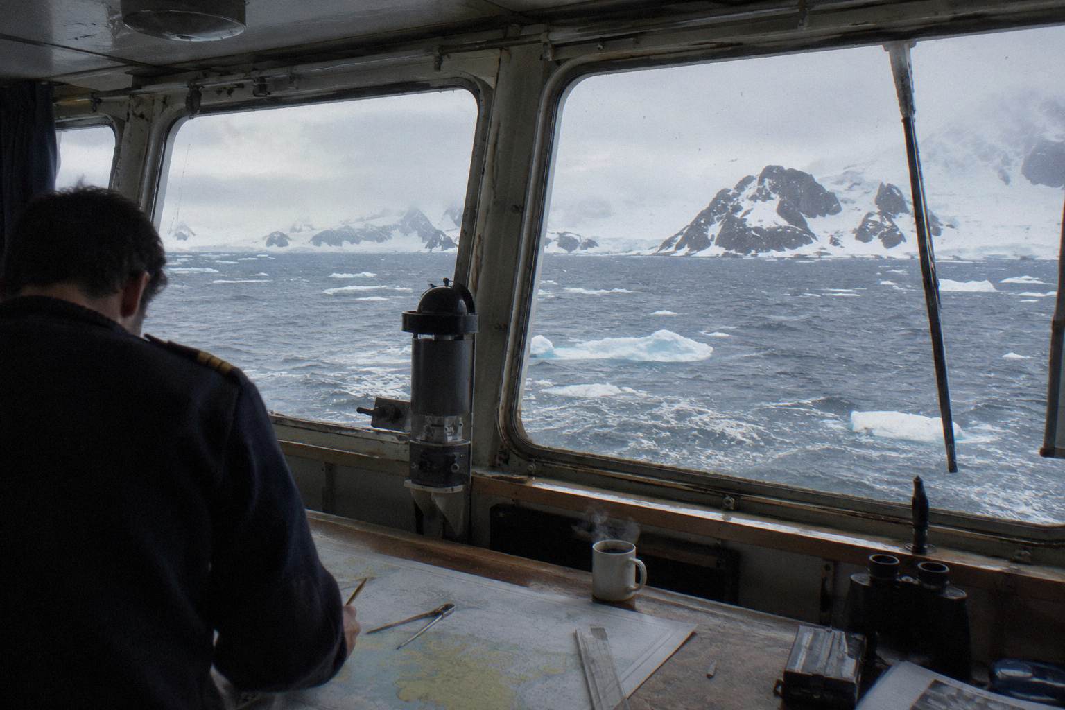
Ice class matters, but it does not grant a licence: a ship's ice class tells you what ice its hull is built to withstand, and on the Peninsula it mainly separates the ships that can push safely into heavier floes from those that must wait for the ice to open, while the itinerary still depends on the season and the ice charts rather than on the steel alone.
Ice class is the most misunderstood number in Antarctic cruise shopping. It is a hull and machinery standard, not a route permit. A higher class means the ship can tolerate more contact with thicker ice, which widens the margins a captain has when the chart shows marginal conditions. Itineraries are planned around ice charts and open water, and the ice class is the safety net for the days when the plan meets reality. Everything else covered here is indexed on Cruises In Antarctica.
The roster of ships sailing Antarctica in 2026-27 shows the spread. Quark Expeditions' Ultramarine carries a 1A+ / PC6 rating, one of the stronger ratings among mainstream expedition ships, alongside its two helicopters and 20 Zodiacs. Oceanwide's Hondius is Polar Class 6, which the operator describes as equivalent to 1A-Super, and is promoted as the first-registered Polar Class 6 passenger vessel in the world. Lindblad's National Geographic Endurance and Resolution hold PC5 Category A, a step higher again on paper. At the other end, Oceanwide's Plancius carries Ice Class 1D, and Quark's World Voyager is rated 1B, yet both are scheduled on Peninsula voyages for 2026-27.
The honest way to use ice class when comparing ships is as a proxy for operational margin, not for itinerary length. Two ships with different ratings will run the same basic Peninsula route in February; the higher-rated ship has more options in November and more fallback positions in heavier ice. If you are booking early season, or an ambitious Weddell or Circle itinerary, the rating deserves more weight in your decision.
| Ship | Class | Passengers | Ice class | From, per person | Voyage length | Departs from |
|---|---|---|---|---|---|---|
| UltramarineQuark Expeditions | Upscale Expedition | 199 | 1A+, PC6 | from $12,236 | 12 to 14 days | Buenos Aires, Ushuaia |
| HondiusOceanwide Expeditions | Small-Ship Budget | 170 | Polar Class 6 | from $7,800 | 11 to 19 days | Ushuaia |
| National Geographic EnduranceLindblad Expeditions (with National Geographic) | Standard Expedition | 138 | PC5 | from $10,800 | 12 to 22 days | Ushuaia |
Which Ships Handle Ice Best
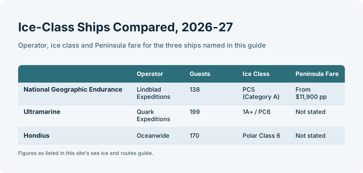
For ice-heavy routing, the strongest-rated mainstream options in 2026-27 are the PC5 Category A sister ships National Geographic Endurance and Resolution, followed by the PC6 group including Ultramarine and Hondius, but the ship that best fits you depends on when you sail and how ambitious a route you want, not on the rating alone.
Consider three ships that represent three different answers. Ultramarine, Quark Expeditions' 199-guest ship, pairs its 1A+ / PC6 ice rating with two twin-engine helicopters and 20 Zodiacs, and Quark's 2026-27 season is billed as its most helicopter-focused yet, which matters because aircraft extend a ship's reach when surface ice blocks a landing. Hondius, Oceanwide's 170-guest small-ship budget option, proves that a strong Polar Class 6 hull does not require a luxury fare; its Peninsula voyages start from $7,800 per person in the 2026-27 season. National Geographic Endurance, at 138 guests with its patented X-Bow and PC5 Category A rating, represents the premium end of the ice-capable spectrum, with 12-day Voyage to Antarctica fares starting from $11,900 per person.
These are different products aimed at different travellers, and the ice is only one input. The budget-conscious traveller who sails in February, when ice is least, gets a full Peninsula experience on a lower-rated hull at a lower fare. The traveller who insists on a November Weddell attempt, or who wants maximum fallback capability on a Circle voyage, gets more real-world value from a higher-rated ship with more expedition hardware. The fare difference between these tiers is large, and the route difference may be small, so it is worth getting expert help matching ship to season before you pay for capability you will not use.
| Ship | Operator | Guests | Ice Class (Roster Wording) | Peninsula Fare, 2026-27 |
|---|---|---|---|---|
| National Geographic Endurance | Lindblad Expeditions | 138 | PC5 (Category A) | From $11,900 pp |
| Ultramarine | Quark Expeditions | 199 | 1A+, PC6 | From $12,236 pp (voyage-level fare shared across Quark ships) |
| Hondius | Oceanwide Expeditions | 170 | Polar Class 6 (equivalent 1A-Super) | From $7,800 pp |
| World Voyager | Quark Expeditions | 168 | 1B | From $12,236 pp (voyage-level fare shared across Quark ships) |
| Plancius | Oceanwide Expeditions | 108 | 1D (Lloyds, at 5 m draught) | From $7,050 pp |
One caution on fares: Quark's published "starts from" figures are voyage-level fares shared across its Antarctic ships rather than ship-exclusive prices, so an Ultramarine departure and a World Voyager departure of the same voyage can carry the same headline number. Our Antarctica cruise ships guide breaks the fleet down ship by ship if you want the full comparison.
How A Warming Peninsula Is Shifting The Ice Season
British Antarctic Survey reporting puts Antarctic Peninsula warming at roughly 0.3 to 0.5 degrees Celsius per decade since the 1950s, and recent winters have brought more rain events replacing snow, which gradually changes the snow and ice conditions cruise passengers encounter even though the season's basic November-to-March shape holds.
The climate context is not abstract for cruise travellers; it shows up in what you step onto. British Antarctic Survey updates note that the Peninsula has warmed at roughly 0.3 to 0.5 degrees Celsius per decade since the 1950s, that recent winters have brought more rain events replacing snow, and that summer rain days are increasing on the northern Peninsula, with some characterizations putting parts of the northwest above 50 rain days a year. Peer-reviewed work on the Peninsula's summer precipitation confirms the mechanism: as air temperatures rise, a larger share of precipitation falls as rain rather than snow.
For routing, the effect is gradual rather than dramatic. The season still runs its November-to-March course, the Drake Passage still takes roughly two days each way, and the ice still peaks in November and bottoms out in February. What shifts, on the margins, is the precipitation: rain instead of snowfall on some northern Peninsula days. Warmer anomalies increase the rain proportion, which is why packing for wet conditions matters as much as packing for cold, a point our Antarctica packing list guide covers in detail.
The wider ice picture also feeds the wildlife timing that drives many bookings. After the October-November sea ice recession, krill abundance draws whales, seals and other marine mammals to Peninsula feeding grounds, which is one reason whale activity builds through January and peaks in February and March.
What The Ice Cycle Means For Your Booking
Match the month to the ambition: November for pristine ice and lower fares with closed sites, December and January for peak wildlife and long light, February for the best odds on Circle crossings and deeper southern access, and March for whales and late-season discounts, because the ice will not bend to your itinerary no matter which ship you book.
Booking an Antarctica cruise is really booking a probability. The ice cycle means every itinerary is a wager on conditions, and your job as a shopper is to load the odds in your favour rather than to find a ship that can guarantee a route, because no such guarantee exists. Shoulder-season November and March departures typically price below the December-January peak, and the product is genuinely different, with more closed sites in November and a winding-down season in March, not merely a cheaper version of the same trip.
The decision sequence we would suggest is simple. First, fix what you most want from the voyage: landings and penguins, a Circle crossing, a Weddell Sea attempt, whales, or pristine ice landscapes. Second, pick the month that maximises the odds of that thing, using the ice cycle described above. Third, choose a ship whose ice class, fare and style fit the month, rather than choosing a ship first and hoping the ice cooperates. A traveller who does this in order ends up with a realistic expectation.
Finally, hold the itinerary lightly. The ships that handle ice best are the ones that plan thoroughly and then change plans without drama, and the travellers who enjoy Antarctica most are the ones who treat a rerouted day as part of the expedition rather than a failure of it. The ice has been setting this continent's schedule for longer than any cruise line has existed, and it shows no sign of consulting a brochure.
Common Questions About Sea Ice And Antarctica Cruise Routes
How does sea ice change Antarctica cruise routes?
Sea ice is greatest in November, which restricts some Peninsula routes and landing sites, recedes through December and January, and reaches its seasonal minimum in February, opening the far south and the Antarctic Circle. Captains adjust the route daily using ice charts, so the brochure itinerary is a plan the ice can override.
When can cruise ships cross the Antarctic Circle?
Antarctic Circle crossings are most feasible from late January through February and into early March, when sea ice is at its minimum and a ship can pass south of 66 degrees 33 minutes south. No operator guarantees the crossing, because it depends on the ice edge at the time of sailing.
Why is the Weddell Sea hard to reach on a cruise?
The Weddell Sea sits on the eastern side of the Antarctic Peninsula, where circulating currents trap and compact pack ice late into the season. Antarctic Sound, the usual entry route, is heavily influenced by that pack, so Weddell access depends on seasonal retreat and weekly ice conditions.
Does a higher ice class mean a better Antarctica itinerary?
Not by itself. Ice class describes what the hull can withstand, not where the ship is permitted to go. Higher-rated ships such as those with PC5 or PC6 classifications have more margin in marginal ice, but the itinerary still depends on the month you sail and the ice charts of that week.
Where do Antarctic cruise ships get their ice information?
Ships and planners use professional ice services such as the US National Ice Center, which publishes weekly Antarctic regional synopses and daily and weekly ice charts showing ice concentration and stage of development, combined with direct observation from the bridge and aircraft.
Is climate change making Antarctica cruise routes easier?
The Peninsula has warmed at roughly 0.3 to 0.5 degrees Celsius per decade since the 1950s, with more rain replacing snow in places. The season's basic shape has not changed, but the change shows up as more rain on northern Peninsula days rather than a different route map.
More Routes And Landings
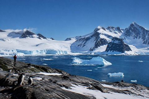 Peninsula CruisesThe classic Peninsula route explained: lengths, fares, landing sites and timing.Read the guide
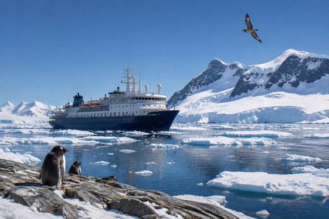 Antarctic CircleLonger, costlier voyages that push past 66 degrees south, and what the extra days buy.Read the guide
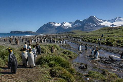 South Georgia CruisesThe 18-to-22-day Falklands, South Georgia and Peninsula itinerary, the premium wildlife cruise.Read the guide
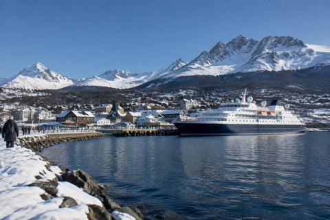 Cruises From UshuaiaShips, routes, fares and arrival logistics for the world's main Antarctica departure port.Read the guide